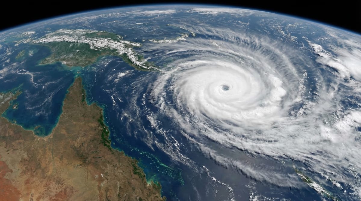
Tropical Cyclone Narelle intensified to category 5 strength on Wednesday with winds near 315 kilometres per hour near the eye. The system is one of the most powerful to threaten Queensland in decades.
TLDR
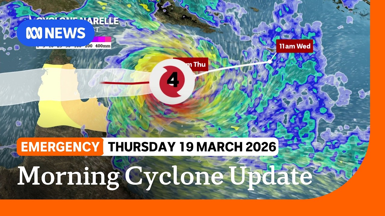
Tropical Cyclone Narelle strengthened to category 5 on Wednesday with winds near 315km/h. The system is expected to make landfall Friday morning near Coen on Cape York Peninsula. It will be the fourth category 5 cyclone to cross the Queensland coast in 50 years, and the first in that area in a century. Nine schools have closed, 780 students are affected, and evacuations are underway from Lizard Island, Port Stewart, and Coen.
KEY TAKEAWAYS
Landfall is expected Friday morning near Coen on the Cape York Peninsula. It will be the fourth category 5 cyclone to cross the Queensland coast in 50 years. It will be the first category 5 landfall in that specific area in 100 years.
Queensland Premier David Crisafulli warned residents on Wednesday afternoon that the scale of the system demanded urgent preparation.
This may be the biggest system that many people have seen in living memory.
— David Crisafulli, Queensland Premier
I can't sugarcoat this; the damage will be widespread with a system of that size.
— David Crisafulli, Queensland Premier
Schools closed, evacuations ordered
Nine schools across the region have closed, affecting 780 students. Evacuations are underway from Lizard Island, Port Stewart, and Coen. Residents have been told to complete preparations by Thursday evening.
The Bureau of Meteorology issued warnings on Tuesday evening as the cyclone rapidly intensified off the coast. The system crossed from category 4 to category 5 strength within six hours on Wednesday morning.
Queensland State Disaster Coordinator Chris Stream issued a blunt warning to residents about the dangers of the storm.
This is not the opportunity for you to be outside during the cyclone, getting that TikTok moment – do not do it. A piece of debris being propelled at over 100km/h will kill you.
— Chris Stream, QLD State Disaster Coordinator
Fuelled by warm Coral Sea waters
The cyclone has been fuelled by unusually warm sea surface temperatures in the Coral Sea, measured at 29-30°C. These conditions have allowed Narelle to rapidly intensify as it tracks west towards the coast.
Meteorologists said the combination of warm waters and low wind shear created ideal conditions for the system to strengthen. The cyclone developed from a tropical low on Monday and reached category 3 by Tuesday afternoon.
After crossing Cape York Peninsula, the Bureau of Meteorology expects the system to re-intensify over the Gulf of Carpentaria and track towards the Northern Territory. Communities in the Northern Territory have been placed on standby for warnings later in the week.
Federal support confirmed
Prime Minister Anthony Albanese confirmed on Wednesday that the Commonwealth is coordinating with the Queensland government on disaster response preparations. Defence personnel have been placed on standby to assist with evacuations and recovery operations.
I've been engaged and will continue to engage with Premier David Crisafulli.
— Anthony Albanese, Prime Minister
Emergency services from southern Queensland and New South Wales are being pre-positioned in Cairns and Townsville. The Australian Defence Force has aircraft ready to conduct damage assessments and deliver supplies once the cyclone passes.
Tropical Cyclone Narelle expected to intensify | ABC NEWS
Rare category 5 event
Category 5 cyclones are the most severe classification on the Australian scale. Winds exceed 280 kilometres per hour. Structures experience extremely dangerous conditions with widespread destruction expected.
Only three other category 5 systems have crossed the Queensland coast in the past 50 years. The last major cyclone to impact the region was Cyclone Yasi in 2011, which made landfall further south near Mission Beach as a category 5 system. Yasi caused approximately $3.5 billion in damage.
Cyclone Larry struck near Innisfail in 2006 as a category 5. Cyclone Monica in 2006 also reached category 5 strength but weakened before crossing the coast.
The Cape York Peninsula typically sees fewer direct cyclone impacts than the central Queensland coast. The last category 5 system to make landfall in the Coen area was in 1926, according to Bureau of Meteorology historical records.
Residents in the path of Cyclone Narelle have been urged to shelter in place once wind speeds exceed 50 kilometres per hour. The window for evacuations closes Thursday evening. Landfall is expected between 6am and 9am Friday morning local time.
SOURCES & CITATIONS
FREQUENTLY ASKED QUESTIONS