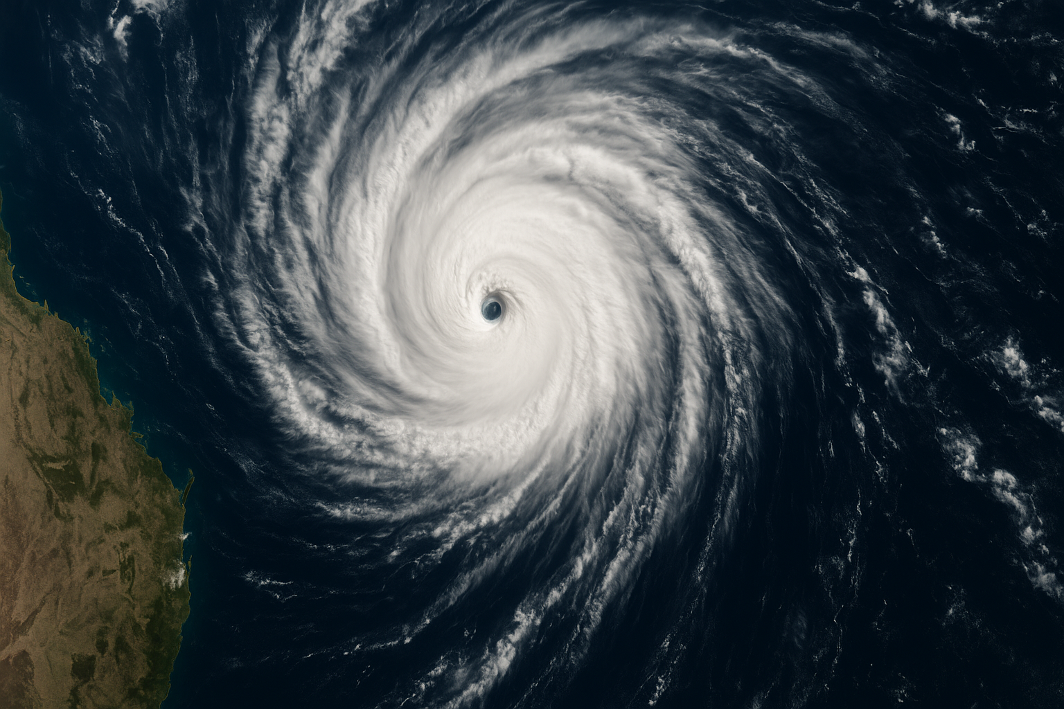
Tropical Cyclone Narelle formed in the northern Coral Sea on Tuesday. The Bureau of Meteorology issued its first track map at 10:41am AEST.
TLDR
Tropical Cyclone Narelle formed in the northern Coral Sea on Tuesday March 17. The system has sustained winds of 85 km/h and gusts to 120 km/h. The Bureau of Meteorology expects it to intensify before making landfall on the far north Queensland coast later this week.
KEY TAKEAWAYS
The system is currently a Category 1 cyclone with sustained winds of 85 km/h and gusts reaching 120 km/h. It is moving southwest toward the Queensland coast at approximately 15 km/h.
BoM forecasters warned the cyclone is likely to intensify before making landfall. A Category 2 or Category 3 system is possible by Thursday.
Forecast track
The most likely track takes Narelle across the coast between Cairns and Cooktown late Thursday or early Friday. However, forecasters stressed that significant uncertainty remains.
The forecast path is the Bureau's best estimate of the cyclone's future movement and intensity. There is always uncertainty in these forecasts.
— Bureau of Meteorology track map statement
A slight deviation north would take the system toward Cape York. A southern deviation could bring it closer to Townsville. Residents across far north Queensland should monitor updates closely.
What to expect
Destructive winds are likely near the centre as the cyclone crosses the coast. Heavy rainfall is expected across a wider area, with totals of 200-400mm possible over 24-48 hours.
Storm surge is a risk for low-lying coastal areas. The combination of high tides and onshore winds can push seawater well inland. Residents in vulnerable areas should consider evacuation before conditions deteriorate.
Power outages are likely. Ergon Energy has crews on standby but restoration can take days in remote areas.
Preparation checklist
- Know your nearest cyclone shelter
- Clear gutters and secure loose items in your yard
- Prepare an emergency kit: water, torch, batteries, first aid, medications
- Charge devices and download the Emergency Alert app
- Fill your car with fuel
- Know your evacuation route if you live in a flood or storm surge zone
Official resources
The Bureau of Meteorology updates its tropical cyclone advice at least every six hours. During active systems, updates may come more frequently.
- BoM Tropical Cyclone Warning Centre: www.bom.gov.au/cyclone
- Queensland Fire and Emergency Services: www.qfes.qld.gov.au
- Emergency Alert system: automatic warnings sent to mobile phones in affected areas
Queensland Emergency Services advised residents not to wait for official evacuation orders if they live in vulnerable areas. Self-evacuation before conditions deteriorate is safer than leaving at the last minute.
Impact zones
Communities between Cooktown and Cairns face the highest risk of direct impact. Smaller townships along the coast have fewer resources for emergency response. Residents in these areas should consider relocating to larger centres with established cyclone shelters.
Cairns itself has weathered many cyclones but remains vulnerable to flooding. The city's drainage systems can be overwhelmed by heavy rainfall. Low-lying suburbs near Cairns Airport and along the Barron River delta are particularly at risk.
Inland communities should not assume they are safe. Tropical cyclones often maintain destructive winds for hundreds of kilometres after crossing the coast. Heavy rainfall typically extends even further, causing flash flooding in areas that rarely see cyclone conditions.
Economic impact
Far north Queensland's tourism industry stands to lose significant revenue if Cyclone Narelle disrupts the region during peak season. Hotels in Cairns and Port Douglas report cancellations already flowing through reservation systems.
Agricultural operations face different concerns. The wet season is winding down and many crops are approaching harvest. A direct hit could destroy banana plantations and sugarcane fields worth hundreds of millions of dollars.
The reef tourism sector watches cyclone tracks closely. Large systems can damage coral and reduce visibility for weeks afterward. Operators along the Great Barrier Reef are preparing vessels and reviewing safety protocols.
Insurance considerations
Homeowners in cyclone-prone areas should review their insurance policies before conditions deteriorate. Most policies require storm preparation measures such as securing loose items and boarding windows. Failure to take reasonable precautions can affect claims.
Renters should confirm their contents insurance covers cyclone damage. Landlords are responsible for building damage but personal belongings are typically the tenant's responsibility.
Background
Cyclone Narelle is the fourth named system of the 2025-26 Australian cyclone season. The Coral Sea typically produces several cyclones between November and April.
The last significant cyclone to affect the Cairns region was Tropical Cyclone Jasper in December 2023, which caused widespread flooding and more than $1 billion in damage.
The Bureau of Meteorology updates its forecasts at least every six hours during active cyclone situations. During the critical period before landfall, updates may come every three hours or more frequently. Residents should not rely solely on mainstream media coverage.
Mobile phone networks can become congested or fail during severe weather. Download offline maps and save emergency contact numbers before conditions deteriorate. Queensland Emergency Services recommends keeping a battery-powered radio as a backup information source.
Schools and childcare centres in affected areas typically close when cyclone watches are upgraded to warnings. Parents should confirm arrangements with their children's facilities and have alternative care plans ready.
SOURCES & CITATIONS
FREQUENTLY ASKED QUESTIONS


